Ex-Tropical Cyclone Lincoln to redevelop between 20-22 Feb 2024
Cyclone Update: 17 Feb at 11:00 am AEST(GMT+10hr), 01:00 am GMT, 7am BST(GMT+6hr)
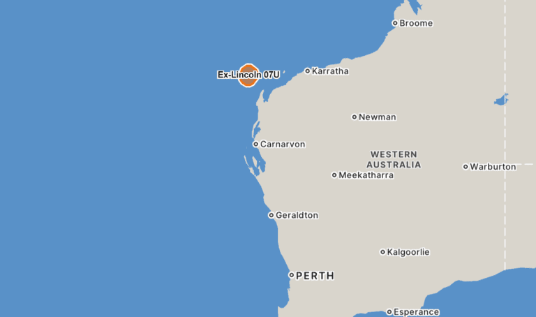
Ex-Tropical Cyclone Lincoln, designated 07U, traverses westward across the Northern Territory (NT), Australia.
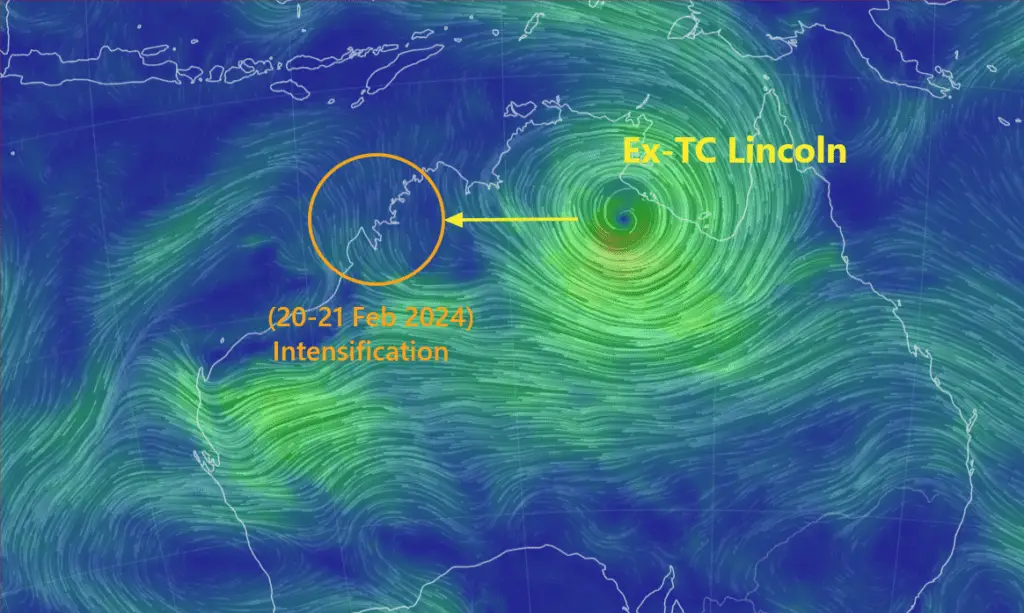
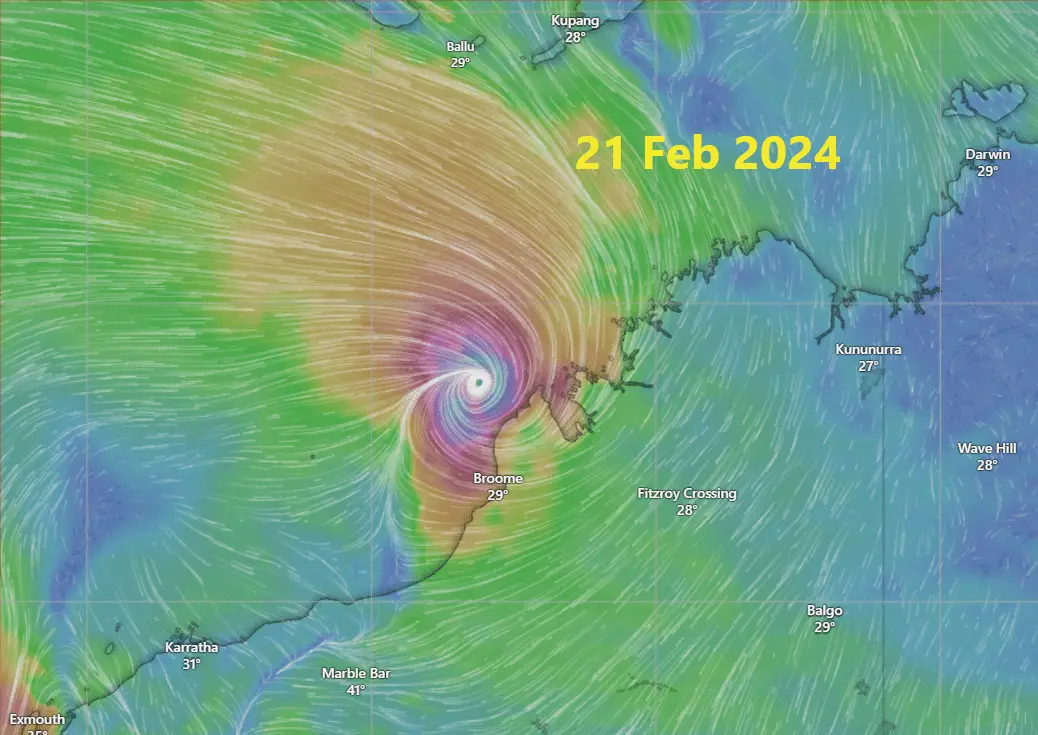
Despite weakening below tropical cyclone intensity, Lincoln is poised to make a comeback. Potentially redeveloping off the Kimberley coast in the upcoming week.
Movement of Cyclone Lincoln
The journey of Ex-Tropical Cyclone Lincoln has been dynamic. After weakening inland, the system is now set to move across central NT. It may reach Kimberley region of Western Australia.
This trajectory forecasts heavy rainfall along its path. Resulting, authorities to issue Severe Weather Warnings for affected areas.
Also Check: Ex-TC Lincoln: Massive Rainfall in Northern Australia
Redevelopment of Ex-Tropical Cyclone Lincoln
As the remnants of Lincoln progress westward, it may emerge into water next week. Meteorologists anticipate its arrival in waters west of the Kimberley and north of the Pilbara by mid-next week.
For specific date around 20-22 Feb 2024. There exists a moderate risk that it may regain tropical cyclone status. Additionally, may transform into a severe tropical cyclone if conditions permit.
Precautions and Unpredictability
The evolution of Ex-Tropical Cyclone Lincoln serves as a reminder of nature’s unpredictability. Basically, showcasing its ability to transition from weakness to potential strength.
Residents and authorities in the affected regions are advised to stay vigilant and heed warnings. Need more attention as the system continues its journey. Should prepare for possible impacts from its resurgence.
Despite the weakening, severe weather impacts are expected to persist. That reflects the continued threat posed by the system even as it weakens.
Residents in the affected areas are urged to remain vigilant and prepared for ongoing severe weather conditions.
Recent History of Lincoln
On Friday afternoon (AEST), the system known as a category one cyclone (Australian Scale) made landfall along the Northern Territory (NT) coast. Its arrival, occurring between Port McArthur and the NT-Queensland border around 4:30 PM, marked a significant event.
However, overnight, the cyclone gradually lost its tropical cyclone intensity. As It continued its southwestward trajectory overland towards the NT’s central Barkly district.
Click here to Check Global Weather News
Track Cyclone on Wind Animation by Weather Model.
Advertisements

