Ex-TC Lincoln: Massive Rainfall in Northern Australia during next 3-5 days.
Heavy Rainfall Warning for Northern Territory, Flash Flooding Expected at Low lying areas of Northern Territory.
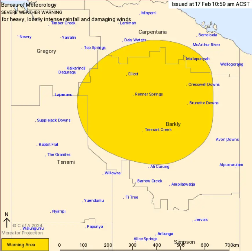
Forecast Valid for people in parts of Carpentaria, Barkly, Gregory and Tanami districts.
Update: 17 Feb at 04:00 pm AEST(GMT+10hr), 01:00 am GMT, 7am BST(GMT+6hr)
Residents of the Northern Territory are urged to brace for severe weather. Because, the Ex-Tropical Cyclone Lincoln continues its west-southwest trajectory across central regions. Heavy rainfall is posing a risk of flash flooding. Which is forecasted for several districts.
Impacts and Forecast of Ex-TC Lincoln: Massive Rainfall in Northern Australia
Southern Carpentaria and Northwest Barkly Districts Forecast:
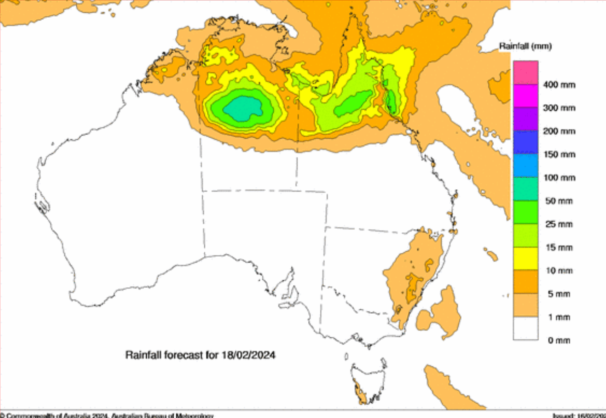
Expect heavy rainfall today with six-hourly totals ranging from 50 to 90 mm.
Northeastern Tanami and Southeastern Gregory Districts Forecast:
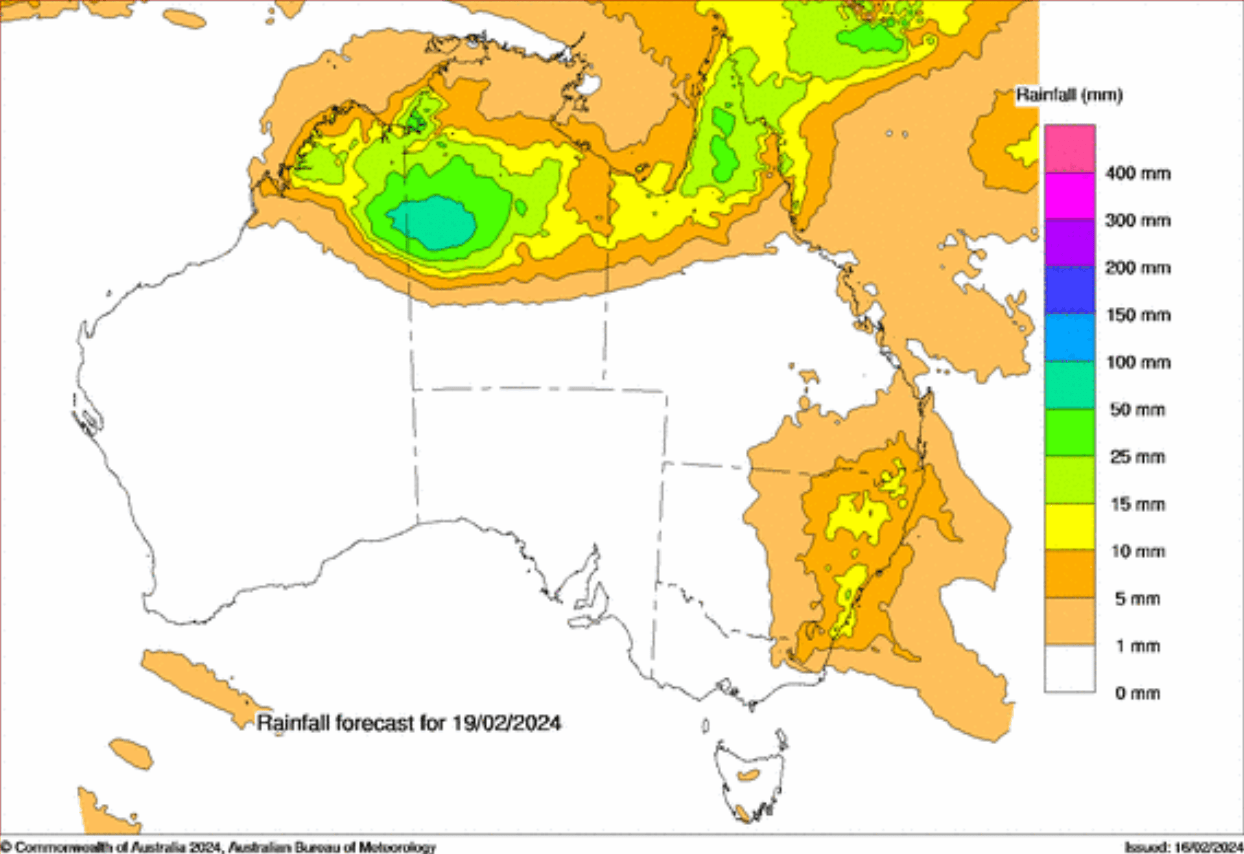
Rainfall is expected to extend into these areas by Sunday morning. Accordingly, 24-hour totals may reach 60 to 90 mm, and up to 120 mm near the System’s center.
Barkly District Forecast:
Locally intense rainfall may lead to dangerous flash flooding from Saturday (17 Feb) evening into Sunday (18 Feb) morning. Along with six-hourly totals exceeding 140 mm and 24-hour totals up to 180 mm.
Also Check: Ex-Tropical Cyclone Lincoln: Redevelopment Possible
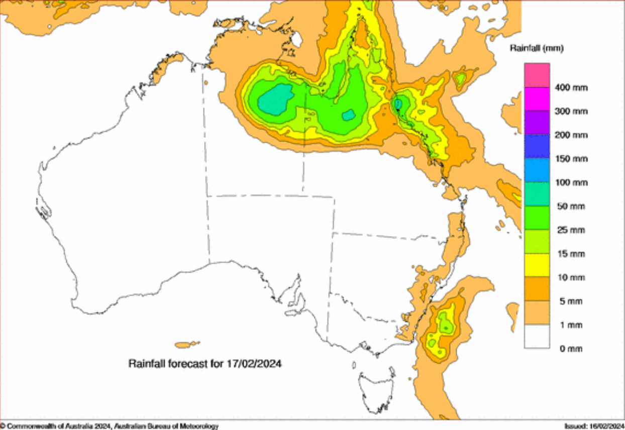
3 Days Rainfall Forecast for Australia as follows :
17 Feb 2024: Bureau of Meteorology
18 Feb 2024: Bureau of Meteorology
19 Feb 2024: Bureau of Meteorology
Strong Winds in northern Australia:
Wind speeds of 50 to 60 km/h with damaging gusts of up to 90 km/h are possible within the warning area.
Warning Area for 24-48 hrs: Bureau of Meteorology
Ex-Tropical Cyclone Lincoln Track: GEFS Ensemble

Precautionary Measures
The Northern Territory Emergency Service (NTES) advises residents to take the following precautions:
*Secure loose outdoor items and seek shelter during deteriorating conditions.
*Pull over in heavy rain if visibility is impaired, using hazard lights until conditions improve.
*Avoid driving into flooded areas and create sandbags to protect homes if flooding occurs.
*Stay clear of flooded drains, rivers, and waterways.
*Ensure the safety of pets and animals.
*Prepare for potential power outages by assembling an emergency kit containing necessary equipments. Such as a radio, torch, spare batteries, and a first aid kit.
*In case of emergencies, contact NTES at 132 500.
Recent Rainfall Totals: Bureau of Meteorology
As of 9 am Saturday ACST, significant rainfall totals include 202 mm at Centre Island.
Residents are urged to stay informed about the evolving weather situation. And also follow advice from local authorities to ensure their safety and wellbeing. For more information and updates, refer to the Bureau of Meteorology website.
Click here to Check Global Weather News
Track Cyclone on Wind Animation by Weather Model.
Advertisements