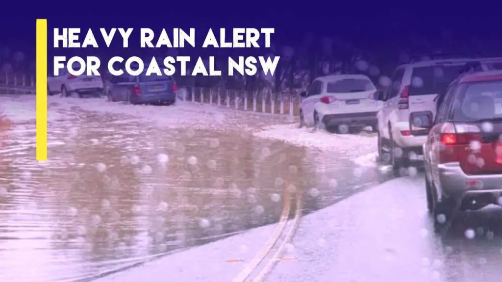
Coastal NSW Weather: Middle to northern Coastal NSW to have Heavy Rain by early next month
NSW weather forecast suggests increased rainfall activity early next month. Accordingly, Coastal NSW to have Heavy Rain towards early next month. Specific date to be March 2nd – 3rd, 2024
➡ Follow us on Google News feed for daily Latest Updates
Saturday, March 2nd: Showers and Heavy Rain Anticipated Across North Coastal Cities
Coastal NSW is expected to experience a shift in weather patterns. Saturday, March 2nd, evolves with increasing cloudiness and the likelihood of showers and heavy rain. Particularly across the northern coastal cities.
The day will commence with a buildup of clouds in the southern regions, gradually extending across most of the coastal areas.
Showers are expected in the morning, primarily affecting the southern parts, while heavy rainfall is anticipated later in the day but predominantly impacting the northern coastal cities.
Eligible Areas for Showers and Heavy rain:
– Sydney
– Wollongong
– Shellharbour
– Kiama
– Nowra
– Ulladulla
– Batemans Bay
– Moruya
– Narooma
– Bega
– Tathra
– Merimbula
– Eden
– Bermagui
– Nambucca Heads
– Macksville
– South West Rocks
– Harrington
– Old Bar
– Taree
– Port Macquarie
– Lake Cathie
– Kempsey
– Sawtell
– Coffs Harbour
Temperatures are expected to range from 20°C to 32°C, with higher temperatures in the extreme northern coasts.
A very high UV index of 6-8 is anticipated, particularly in the extreme northern cities. A south-southeasterly wind blowing at 15-25 km/h may contribute to prevailing humidity levels.
Sunday, March 3rd: Reduced Humidity with Continued Showers or Rain, Mainly in the Northern Cities
As the week concludes, Sunday, March 3rd, is forecasted to bring reduced humidity levels. Despite this, intervals of clouds and sunshine are expected to persist across most of the middle to south coastal areas.
Showers or rain are likely to continue in coastal cities, especially in the northern regions.
Eligible Areas for Rain or Showers:
– Batemans Bay
– Ulladulla
– Nowra
– Kiama
– Shellharbour
– Wollongong
– Sydney
– Lake Cathie
– Port Macquarie
– South West Rocks
– Nambucca Heads
– Macksville
– Harrington
– Old Bar
– Taree
– Kempsey
– Sawtell
– Newcastle
– Coffs Harbour
– Woolgoolga
– Grafton
– Maclean
– Yamba
– Iluka
– Evans Head
– Ballina
– Lennox Head
– Byron Bay
– Lismore
Temperatures are expected to range between 19°C to 24°C, higher to the south. A very high UV index of 8 likely but mainly over Southern Coastal Cities. A southeasterly wind blowing at 20-25 km/h is forecasted to maintain comfortable conditions.
New: Coastal NSW Weather to Have Increased Rainfall or TS Later this Week
Related: Sydney Weather to have reduced rain earlier but increase later this week
Read More: North Western NT Weather may have Daily Rain Rest of This Month
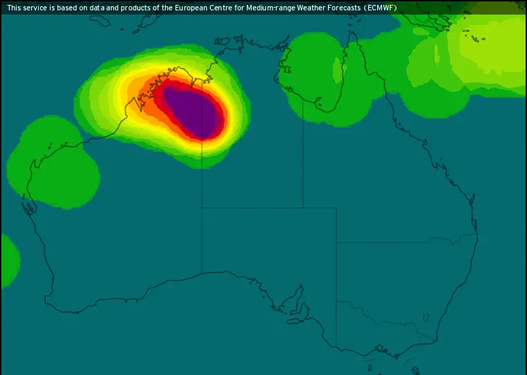
ECMWF Rainfall forecast Till 3rd March 2024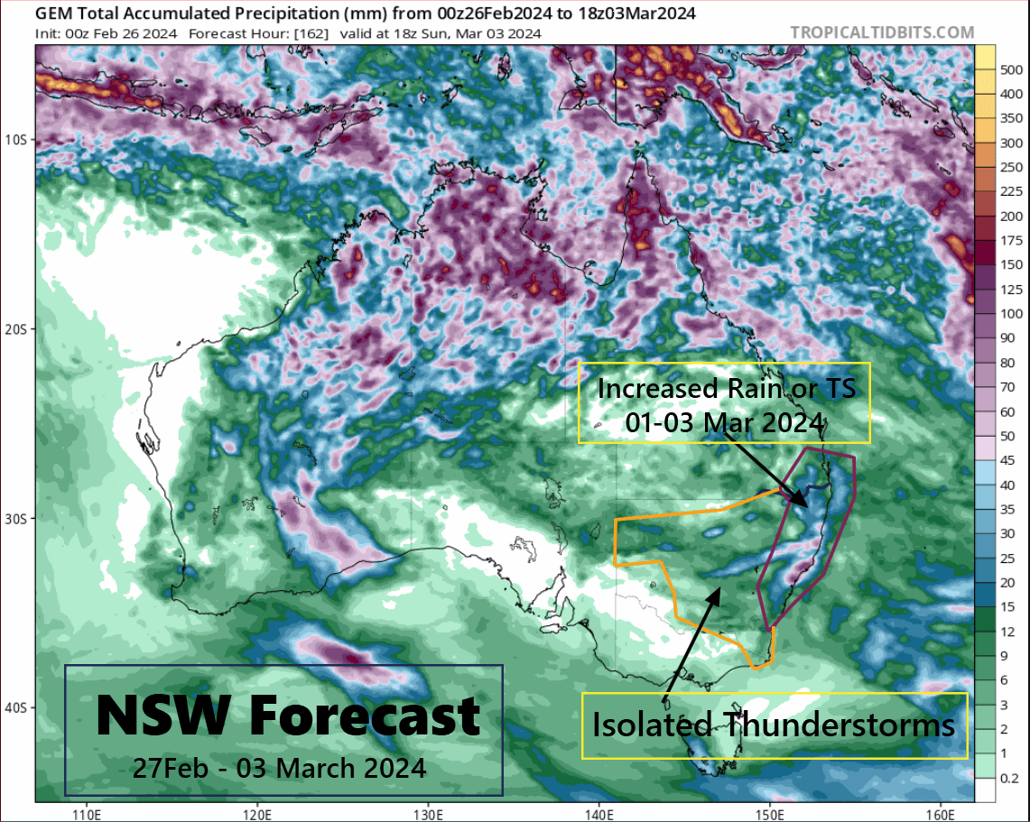
Forecast Summary for Coastal New South Wales
The upcoming week for Coastal NSW promises variable weather conditions, with fluctuations between hot and humid spells to cooler periods with rainfall.
Staying updated with the forecast will be crucial for planning outdoor activities and commuting throughout the week.
Advertisements