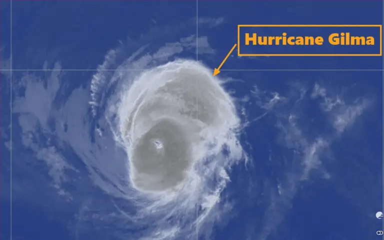
of Hurricane Hurricane Kiko Strengthens as Category 4 Storm – September 4, 2025, 5:00 AM HST Update
The National Hurricane Center (NHC), issued by the Weather Prediction Center (WPC) in College Park, MD, released the latest advisory for Hurricane Kiko at 5:00 AM HST (1500 UTC) on Thursday, September 4, 2025. The powerful system continues as a Category 4 hurricane in the eastern Pacific, showing signs of inner-core stabilization after undergoing an eyewall replacement cycle (EWRC).
Current Position and Motion of Hurricane Kiko
Location (1500 UTC): 13.8°N, 133.7°W
Distance: Far east of the Central Pacific, tracking westward toward Hawaii
Movement: West at 15 km/h (8 knots)
Kiko is being steered by a strong subtropical ridge to its north and northwest. This pattern is expected to hold through the day before gradually weakening due to an upper-level trough developing near Hawaii.
Intensity and Structure of Hurricane Kiko
Maximum Sustained Winds: 213 km/h (115 knots)
Category: 4 (Saffir-Simpson Scale)
Pressure: Not provided in this advisory, but indicative of a major hurricane system
Satellite imagery shows that Kiko has weakened slightly compared to last evening, primarily due to an eyewall replacement cycle. However, convection has stabilized, especially along the southern flank of the eyewall. Both subjective and objective Dvorak estimates place Kiko at Category 4 strength, with potential for re-intensification once the EWRC completes.
Forecast Intensity Outlook of Hurricane Kiko
The environment remains favorable in the short term, with warm sea surface temperatures and low wind shear supporting re-strengthening. Forecast models, including HAFS-A and HAFS-B, suggest Kiko will maintain Category 4 intensity (209–231 km/h) for at least the next 48 hours.
12 Hours (Sept 5, 0000 UTC): 222 km/h (120 knots)
24 Hours (Sept 5, 1200 UTC): 231 km/h (125 knots) – Potential peak
36 Hours (Sept 6, 0000 UTC): 222 km/h (120 knots)
48 Hours (Sept 6, 1200 UTC): 213 km/h (115 knots)
After 72 hours, conditions become less favorable:
Wind shear increases due to stronger upper-level southwesterlies.
Sea surface temperatures drop below 26°C, limiting energy supply.
As a result, Kiko is forecast to gradually weaken, with winds decreasing to 157 km/h (85 knots) by 96 hours, and further down to 111 km/h (60 knots) by day 5 as the storm nears Hawaii.
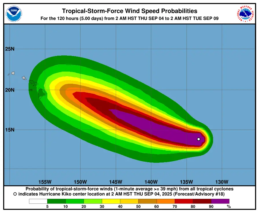
Hurricane Kiko Forecast Track
Current Track: Due west (270°) at 15 km/h
24–48 Hours: Begins shifting west-northwest as the ridge weakens
72–120 Hours: Continues west-northwest, gaining latitude toward Hawaii
By early to mid next week, Kiko is expected to approach the Hawaiian Islands, though exact impacts remain uncertain.
Key Hazards and Risks
1. Wind and Rainfall Threats:
Direct impacts on Hawaii remain possible early to mid next week.
While still uncertain, the risk of damaging winds and heavy rainfall is increasing.
2. Marine Impacts:
Large swells and hazardous seas are expected along Kiko’s path.
Mariners should avoid the system’s projected track.
3. Forecast Uncertainty:
While short-term track guidance is tightly clustered, long-range spread increases, raising uncertainty in Kiko’s potential Hawaiian impact.
Forecast Positions and Maximum Winds of Hurricane Kiko
04 Sept, 1500 UTC: 13.8N, 133.7W – 213 km/h (Category 4)
05 Sept, 0000 UTC: 13.9N, 134.9W – 222 km/h
05 Sept, 1200 UTC: 14.3N, 136.6W – 231 km/h
06 Sept, 0000 UTC: 14.7N, 138.3W – 222 km/h
06 Sept, 1200 UTC: 15.3N, 140.1W – 213 km/h
07 Sept, 1200 UTC: 16.7N, 144.0W – 194 km/h
08 Sept, 1200 UTC: 18.3N, 148.1W – 157 km/h
09 Sept, 1200 UTC: 19.9N, 152.8W – 111 km/h
Key Takeaway of this East Pacific Hurricane
Hurricane Kiko remains a dangerous Category 4 storm in the eastern Pacific. While it may slightly weaken in the coming days, it is forecast to remain strong as it tracks west-northwest toward Hawaii. Residents and interests in Hawaii should closely monitor official updates as the risk of wind and rainfall impacts grows heading into next week.
Update Time: September 4, 2025 – 5:00 AM HST (1500 UTC)
Source: National Hurricane Center (NHC) – Discussion #18
If You are in an old update, Check new updates here (Click Me)
Advertisements