Severe Thunderstorm Risk Grows Across Queensland Ahead of Christmas
Updated: 24 December, 9:00 AM AEST (QLD Standard Time)
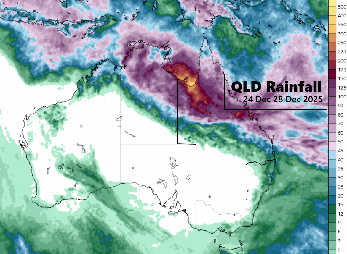
Queensland is set to experience an active and potentially hazardous weather pattern over the coming days as a strengthening trough system interacts with the monsoon trough, increasing the risk of widespread rain, thunderstorms, and severe weather across large parts of the state.
Meteorologists report that a monsoon trough currently lies over northwest Queensland, connecting with a trough over the southeast. A weak ridge remains in place over other regions, but this stability is expected to weaken as the southeast trough intensifies from Thursday onward.
Queensland Weather Situation Overview
The southeast trough is forecast to strengthen on Thursday, then gradually move northward along the Queensland east coast during the following days. By Sunday or Monday, the system is expected to reach north Queensland, bringing increased rainfall and thunderstorm activity.
Meanwhile, the monsoon trough in the northwest may extend east later this week, enhancing moisture availability and increasing the risk of prolonged rainfall. From Friday, a ridge of high pressure will extend over southern Queensland as a high system approaches and crosses Tasmania. This high will move into the southern Tasman Sea on Sunday, influencing wind patterns across the state.
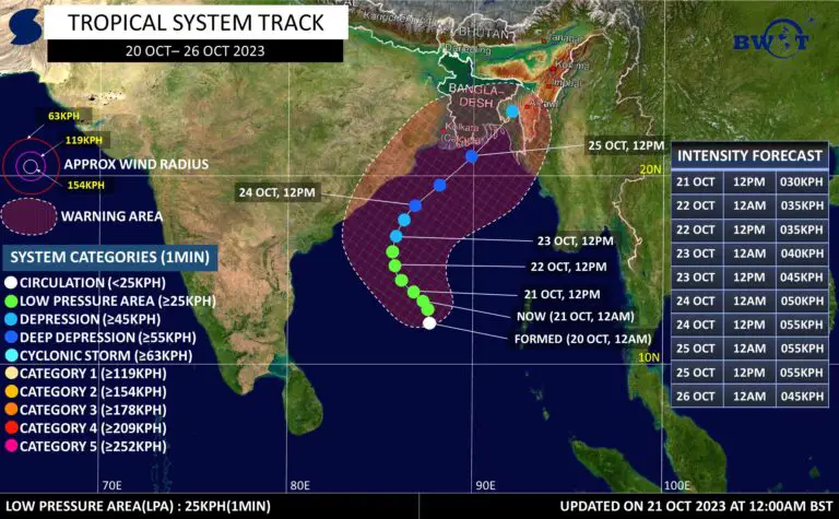
A weak tropical low (09U) may develop in the Coral Sea on Sunday, with current guidance suggesting it is most likely to move away from the Queensland coast from Monday. While the system is expected to remain offshore, it may still contribute to unsettled marine and coastal conditions.
Today’s Forecast of Queensland – Tuesday, 24 December
Conditions today will be mostly clear in the far southwest, while isolated to scattered showers and thunderstorms are expected elsewhere. In the northwest, showers may tend toward periods of rain.
There is a risk of severe thunderstorms across northern, central, and southeastern Queensland, with heavy to locally intense rainfall possible. In the southeast, large hail is an additional hazard.
Winds will generally be light to moderate from the northeast to southeast, turning southeast to southwesterly inland near the NSW border. Winds may become fresh at times in the far southwest, while northwest to northeasterly winds develop in the far north and eastern districts.
Christmas Day Forecast of Queensland – Wednesday, 25 December
Christmas Day will bring mostly sunny conditions in the southern interior, but elsewhere, isolated to scattered showers and thunderstorms are expected, becoming widespread at times with periods of rain.
Severe thunderstorms remain a concern, particularly in northern and central Queensland, where heavy to locally intense rainfall is possible. In the southeast, storms may produce damaging wind gusts and large hail.
Additional hazards include morning fog in the southeast and raised dust in the far southwest. Temperatures will be above average in the far southeast, near average in parts of the south and northeast coast, and below to well below average in the northwest.
Queensland Friday Weather Outlook – 26 December
On Friday, the southern interior will remain mostly sunny, while northern and central Queensland can expect scattered to widespread showers, rain, and thunderstorms. Severe storms with heavy to intense rainfall remain possible.
The southeast will see isolated to scattered showers and storms, with less humid conditions developing later in the day. Temperatures will be near average in southern Queensland, but well below average in the northwest and northern interior.
QLD Weekend Forecast – Saturday and Sunday
Saturday, 27 December, QLD Weather Forecast
Saturday will bring mostly sunny conditions in the southern interior, while eastern districts south of Gladstone see isolated showers. Elsewhere, widespread rain and thunderstorms are forecast, with severe storms possible in northern and central Queensland.
Sunday, 28 December, QLD Weather Forecast
On Sunday, scattered to widespread showers and thunderstorms will continue across much of the state. Northern Queensland and the Central Coast remain at risk of severe thunderstorms with heavy rainfall. Inland areas between Georgetown and Moranbah may experience well below average temperatures.
Key Weather Hazards to Watch over Queensland
-
Severe thunderstorms with heavy to intense rainfall
-
Risk of large hail and damaging winds in the southeast
-
Flash flooding potential in storm-prone areas
-
Possible impacts from a developing tropical low offshore
Residents are advised to stay updated with the latest forecasts and warnings, particularly during the Christmas and weekend period, as weather conditions may change rapidly.
If You are in an old update, Check Latest (Click Here)
Advertisements