Tropical Low Update: Multiple Systems Pose Potential Cyclone Threats to Australian Coasts
Weather Update: 9:58 AM Tuesday, March 12, 2024 Australian Western Standard Time (AWST)
As the Tropical Cyclone season continues to unfold across the waters of northern Australia, meteorologists are closely monitoring several developing weather systems that could pose threats to coastal regions.
Tropical Low 08U passing south of Christmas Island and heading towards Western Australia, alongside Tropical Lows 09U and 10U potentially brewing in the Gulf of Carpentaria and the Coral Sea respectively. Residents and authorities are urged to remain vigilant and prepared for possible impacts.
Additionally, keep yourself updated with the latest information in case multiple cyclone forms this week. Here’s an overview of their current trajectories and potential impacts:

Tropical System 08U: May Develop into a Tropical Cyclone by Thursday into Friday and Impact WA Coast
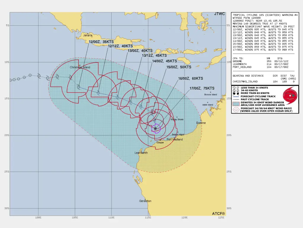
Tropical Low 08U currently poses a threat to Christmas Island and is expected to bring strong to gale force winds to the area. As it continues its trajectory towards Western Australia, there are concerns it may develop into a tropical cyclone.
According to JTWC, Low 08U already attained cyclone status with winds of 65kph (1 min). While Bureau of Meteorology is still tracking it as a Tropical Low with winds of 55kph.
According to Bureau of Meteorology, There is a high risk of Cyclone development on Thursday into Friday. So, residents in the region are advised to stay vigilant. Generally, The system is tracking eastwards, accompanied by a strengthening monsoon to its north.
As the week progresses, 08U is projected to veer southward. It may stay offshore of the Western Australian mainland. However, there remains a risk of cyclone impact to the Pilbara or west Kimberley coast by late Friday into Saturday.
Tropical System 09U: Low Risk of Cyclone Formation
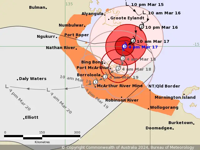
Meanwhile, Tropical Low 09U presents a lower risk of tropical cyclone formation at this time. It may primarily affect the Timor Sea and Gulf of Carpentaria. There’s a possibility it may move east-southeast and cross the western Top End coast before entering the Gulf of Carpentaria.
According to Multiple Agency Estimates, The Low 09U is spinning with 30-40kph Winds And characterized as a monsoonal system. By Wednesday or Thursday, it could make landfall either along the north Kimberley or western Top End coast as a Tropical Low.
Comparatively, The likelihood of it developing into a Tropical Cyclone before reaching the coast is currently low. Over the weekend, the system may traverse the Gulf of Carpentaria waters, posing another low risk of cyclone development.
Tropical System 10U: Developing system bringing Coral Sea Potential Threat
Tropical Low 10U presents a low risk of developing into a Tropical Cyclone in the Coral Sea till now. Originating along the monsoon trough off the eastern Top End in the Gulf of Carpentaria, this system is forecasted to move east-southeast.
According to Multiple Agency Estimates, The Low 10U is spinning with 35-45kph Winds and characterized as a monsoonal system.
Eventually, It may reach the Coral Sea by Thursday. Although it may become a small Tropical Cyclone, the likelihood of significant impacts on the east Queensland coast remains low as it’s expected to stay well offshore.
Potential Impacts by Multiple Systems Over AU Coast
The Trio of Low-pressure systems have the potential to bring adverse weather conditions to their respective regions. Residents along the Pilbara, west Kimberley coasts should closely monitor the progress of Low 08U. Basically, Strong winds, heavy rainfall, and rough seas could accompany its passage. It may require preparedness measures.
Similarly, communities in the north Kimberley and western Top End coast should stay alert for updates regarding Low 09U. Because, it could bring heavy rain and inclement weather upon landfall. Also, There is a potential for redevelopment of this system across Gulf of Carpentaria.
Tropical Low 10U may affect eastern Top End in the Gulf of Carpentaria Tomorrow. And may enter into the Coral Sea by Thursday. While bringing heavy rain and some strong winds across eastern top end in the Gulf of Carpentaria, it may not become a threat for eastern Queensland after entering into the Coral Sea.
Read More:
Tropical Low: Two Systems Pose Potential Threats to Australian Coasts
Melbourne Weather: Rain May Return to Melbourne, Australia by Middle of the Next Week
What to do to remain safe?
As Low 08U, 09U and 10U looming across North West and North of AU, authorities and residents alike must remain vigilant and prepared for any eventualities. Regular updates from meteorological agencies are crucial in staying informed about the developments of these systems and taking appropriate precautions to ensure the safety of coastal communities.
If You are in an old update, Check new updates here (Click Me)
Advertisements